Nightmarish Roads in British Columbia
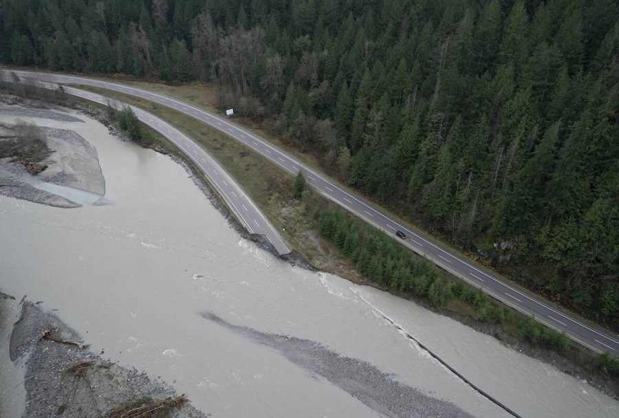
Some of British Columbia’s most important highways were partially destroyed after an atmospheric river hit the province last November.
Usually, North Vancouver has an average of 244 mm of water during the month of November, but this year, this count was exceeded by 80 mm in only two days. This is the main reason why people weren’t prepared for the massive floods that followed these two days. The heavy rain caused a lot of mudslides on the roads and even caused bridges to fall.
With 10 000 daily users, the Coquihalla Highway is one of the most important roads of the province. It’s the main road between the south of the province and the center. The Coquihalla, also known as Highway 5, is damaged at 20 different sites over 130 kilometers. According to Transportation Minister Rob Fleming, this route could reopen to commercial uses only in two months: “ We’re reasonably optimistic that enough repairs can be completed to allow commercial traffic on the corridor in two months in late January.”
Highway 1, part of the Trans-Canada Highway, was also heavily damaged at 4 places, including a completely washed out section. Again, the traffic could reopen in mid-January for essential transport.
John Clague, emeritus professor of Earth sciences at Simon Fraser University in Burnaby said that the areas that were the most impacted by the wildfires earlier this year suffered more of the floods and landslides than other parts of the province.
“Since the soil no longer absorbs water, the water runs down very, very quickly and starts to scour out things,” said Bob Freitag, director of the institute for Hazards Mitigation, Planning and Research at the University of Washington.
The transportation minister estimated the cost of the road repair to be between 170m $ and 220m $